Tag: Eric Fischer
-
See and Say in the San Francisco Bay
I’ve written about Eric Fischer’s work before (Digital Cartography, Digital Contrails). His work takes massive amounts of data and plots them geo-spatially to create beautiful maps. His latest piece shows Twitter and Flickr around the San Francisco Bay. Red dots are locations of Flickr pictures. Blue dots are locations of Twitter tweets. White dots are…
-

Digital Contrails
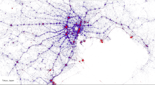
What do you do when you have access to the twitter firehose and a top notch geo-visualization artist? Make beautiful maps of course! Gnip and Eric Fischer got together with MapBox and plotted millions of tweets by location, language, and device to come up with some fantastic interactive maps. The map above is Tokyo…
-
Digital Cartography
Eric Fischer takes large datasets and turns them into art. His flickr stream is a collection of fascinating time-series maps plotting data over time to draw out shapes which take on a greater meaning. Weather it’s a map of taxis in San Francisco or an overlay of flickr metadata on top of NYC, Eric’s creations are at once…